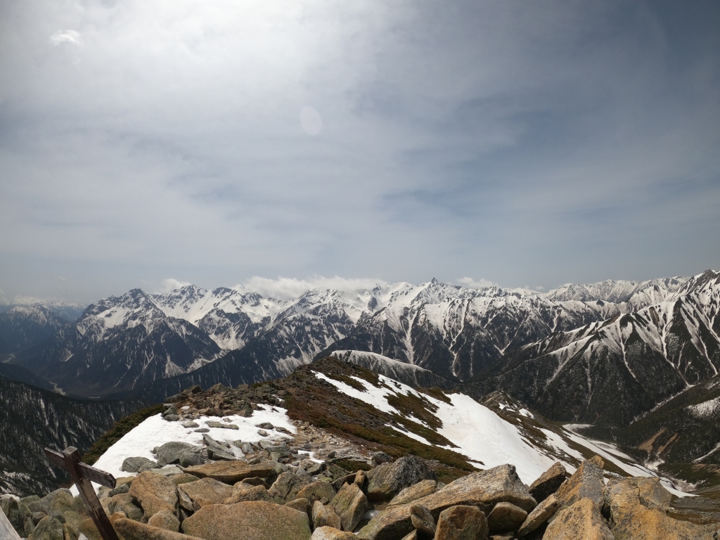
Hello again everybody, Alex back again with another mountain blog post. This time I’ll cover a quick day trip mountain, rather than a series: venturing out to Mount Jōnen: one of the Easternmost mountains within the Northern Alps. At 2,857 metres elevation, it acts as an excellent vantage point to observe the Hotaka-Yari ridgeline to the West, as well as the surrounding mountains of Mount Chou (butterfly/蝶ヶ岳) to the South, and Mount Tsubakuro to the North (燕岳).
Asterisk one marks the starting point of this trip: Ichinozawa (一ノ沢), whilst to the South, asterisk two marks Ninozawa (二ノ沢), another popular starting route for those intending to do the loop trail from Mae-Jōnen – Jōnen – Mount Chou/Chougatake. Mae-Jōnen is indicated on this map by the blue dot just to the right of Mount Jōnen’s main peak. As mentioned earlier, Mount Hotaka as well as Yari can be observed to the West from Mount Jōnen, and even signs of the distant Mount Washiba to the Northwest can be made out, too.
Anyways, with today’s route I would be starting from Ichinozawa as indicated on the map above, and taking a beeline straight for Mount Jōnen via an area called Jōnenkoshi (常念越), which is reached via a long stretch of ascending a snow field. Certainly a relatively new experience for me, but an opportunity to breakout the crampons and get some proper usage out of them, so I was certainly looking forward to the trip as a whole. The return journey I estimated as taking approximately 9-10 hours after referring to a couple of reports of people who had done the same route, so with that in mind after arriving at Kōfu station (甲府駅) in Yamanashi prefecture, took the (unfortunately, rather expensive – 7,000 yen/~50 pounds) bus to Ichinozawa trailhead, and begun my trip at around the 07:00am mark. Relatively late for a daytrip, but unavoidable due to my lack of car.
As always, I’ll explain the rest in the captions below, and will leave some concluding thoughts at the end. For now, I hope you enjoy my 30th hundred famous mountain, as it was an overall, very pleasant experience!
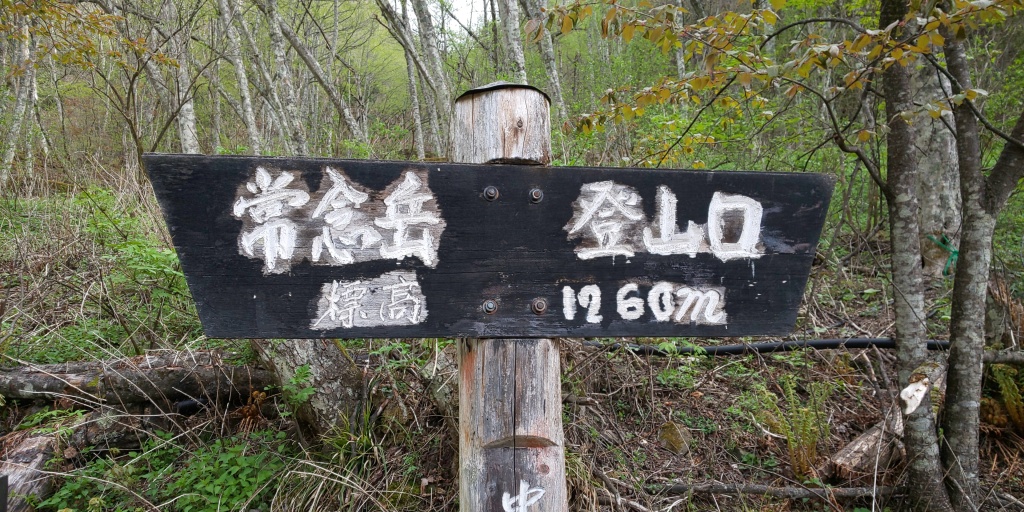
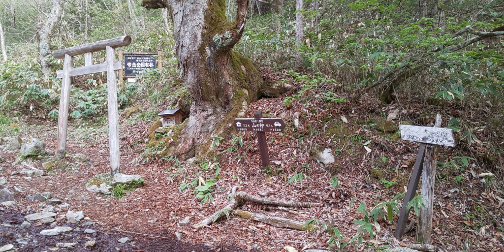
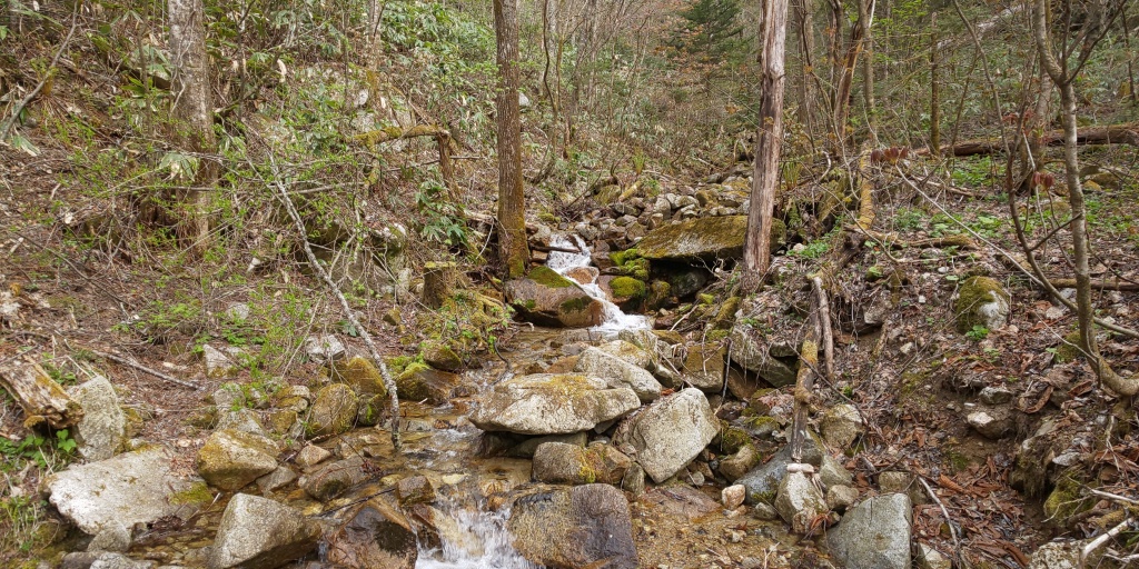
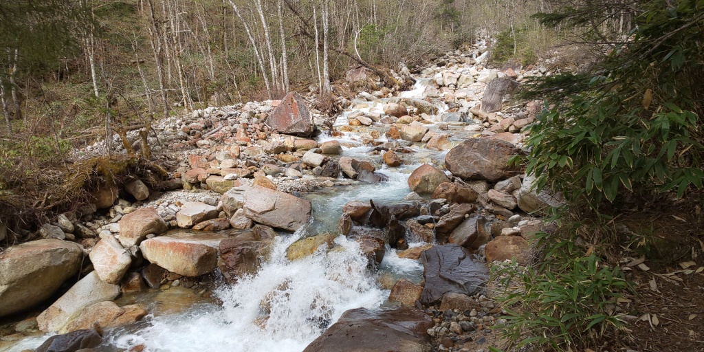
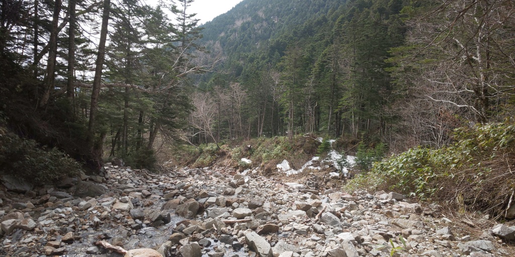
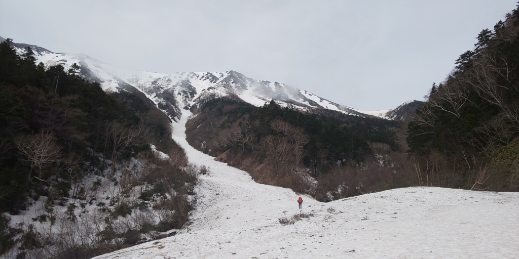
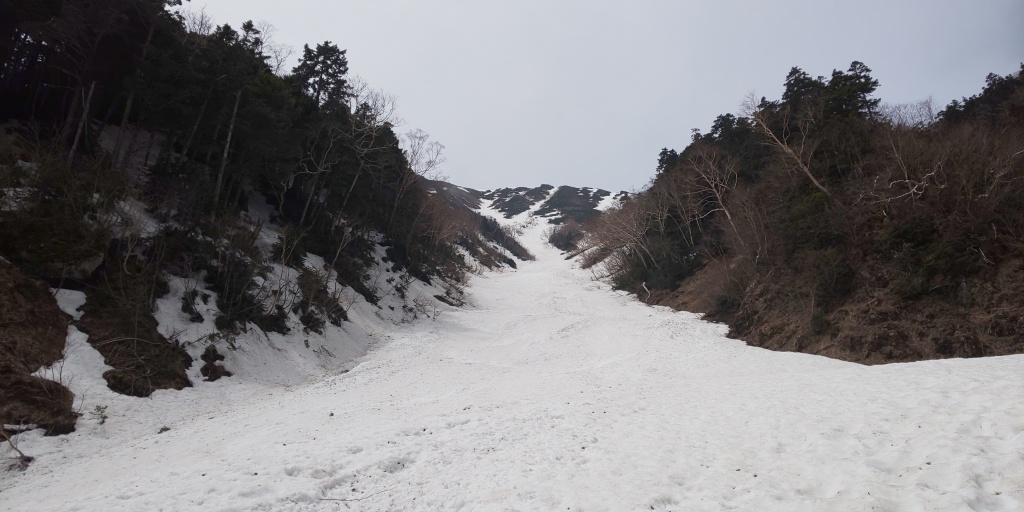
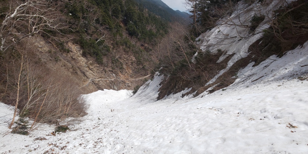
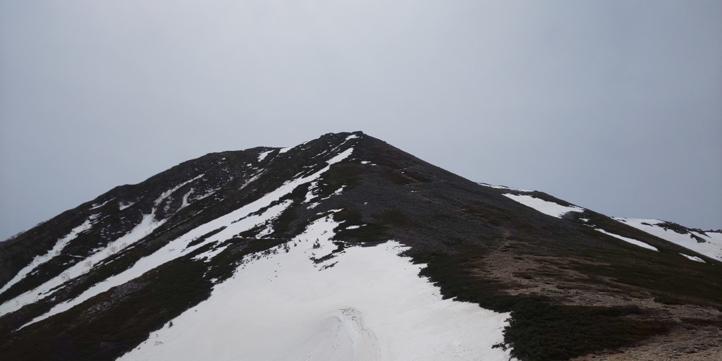
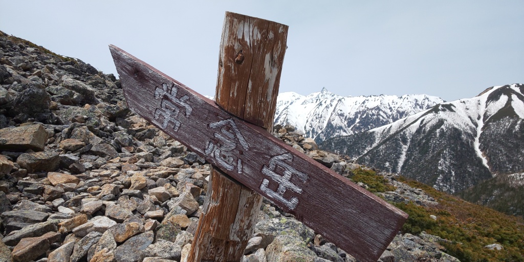
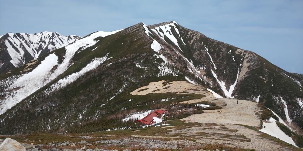
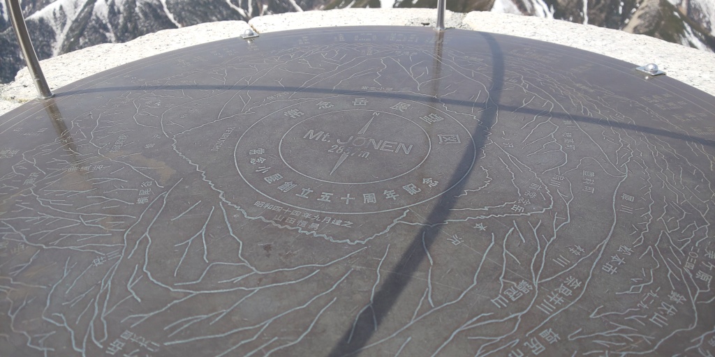
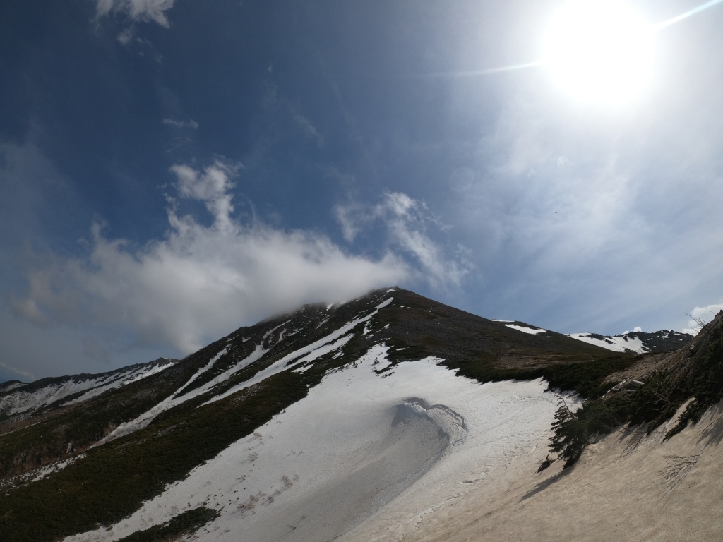
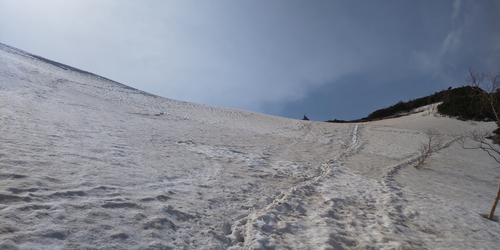
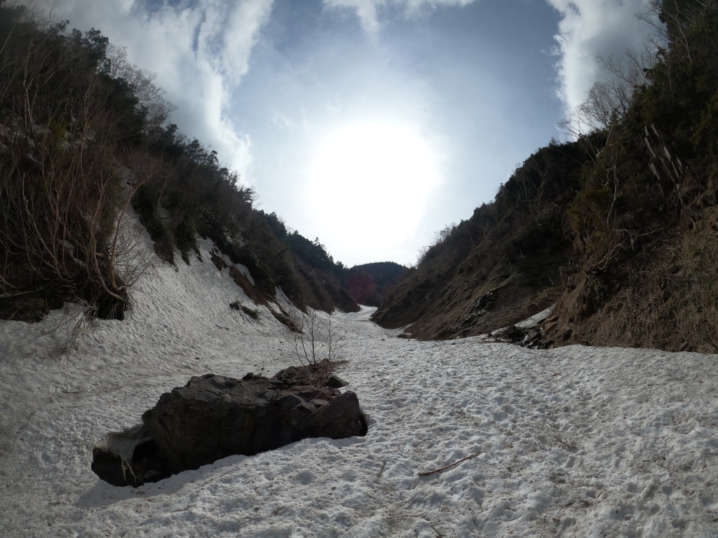
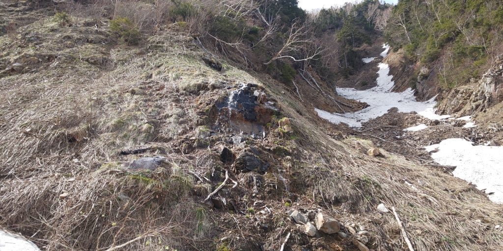
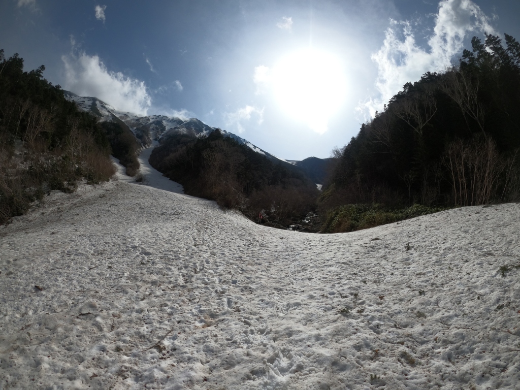
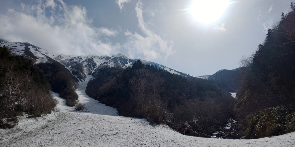
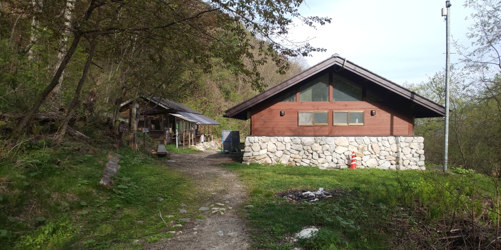
The starting point of the Ichinozawa trail, at a relatively high elevation of 1,260m. 1,600m or so of elevation change is not too extreme, but still somewhat of a challenge for a day-trip, so I steeled myself with that in mind and pressed on under the slightly ominous looking clouds overhead.What appeared to be a shrine of sorts 10 minutes or so on from the previous picture. Not many people whatsoever at this time (I assume most people with common sense would set out much earlier than 07:00, but heyho, hopefully I would catch up at some point!A nice, serene mountain stream feeding into Ichinozawa. The latter’s name sake can be loosely translated as “River/stream number one”, so it was no surprise that the majority of the ascent prior to the snow appearing was accompanied by the sound of water flowing by, which added to the relaxing nature of the first half of this hike.A part of the aforementioned Ichinozawa. The first leg of the trip required traversing across this on numerous occasions, so I’m glad that I made this trip in May, prior to the rainy season beginning in Japan in June. With the increase in water flow due to the rainy season (as well as snow melting season coinciding with the latter), crossing this with higher water levels would have presented a considerable challenge, I imagine.“Otaki”, or “Large waterfall” if translated literally. Unfortunately it seemed that the waterfall was not feeling particularly large today, as it was very much dried up/only dribbling down the mountain, hence no picture other than this signpost. Either way, a steady 2.1km travelled already, and only 3.6km of ascent left to go until Jōnenkoshi, the area where Jōnen mountain lodge is located, and only a kilometre or so from the peak of Mount Jōnen itself.The fallout from what I would typically assume to be a fully flowing river coming from Otaki/Large waterfall. I imagine the water level here increases dramatically post-rainy season/snow melting season, so it might be an idea to visit here in July/August if that sort of scenery is your cup of tea!The appearance of snow was fairly sudden, but beautiful nonetheless! As you can probably tell, I also managed to catch up with three people that had set off an hour and a half before me, so I realised quite suddenly that my pace had been (a bit too) quick. Thus, moving forward, although crampons would inevitably slow me down, I put an emphasis on pacing myself moving forward, as it would only get more difficult moving on from here. Mount Jōnen is the peak slap bang in the middle of this shot, looming over the valley that this shot was taken in. The route moving onwards would wind upwards, towards the right, rather than the left, obvious looking snow ascent. The latter route would instead take you to Mount Mae- Jōnen, apparently.Looking back down the snow valley after ascending a good couple of hundred metres. Rather exhausting!Looking up the snow valley, and although feeling like not making any progress, making fairly good time!Looking back down to where the previous shot was taken. There were a number of loose rocks tumbling from the cliffs either side here, which justified extra care to be taken for sure.The final slog of the snow valley. Although seemingly lacking in diversity (in terms of pictures), I think I was more focused on putting one foot in front of the other, making this leg not as painful as I was expecting it to be!Looking up towards the left (South) whilst ascending the last portion of the snow valley, where Mount Jōnen lay. The clouds would, fortunately, soon clear up a bit more! A spectacular view of Mount Yari (3,180m), aptly named due to its “spear” like appearance jutting out of the ridge. (Yari translates to spear from Japanese). The portion leading South from Mount Yari certainly appeared to still be in deep winter season, and would expectedly change given a couple of months.The signage indicating Mount Jōnen at Jōnenkoshi, the rest of the ascent from here would not require crampons due to it being entirely being comprised of rocks. (Apart from a portion very near the summit where a bit of snow still remained, but could be avoided altogether) Looking back down towards Jōnenkoshi, with the weather beginning to clear up for the better. The mountain lodge (and its red roof) can also be seen in the middle of this shot, (unexpectedly) doing business at this time of year. Final signage indicating the direction to Mount Jōnen’s peak. Should one wander directly forward from this point, you would go off the official trail, but eventually be able to make your way to Mae-Jōnen. It is worth noting, however, that traversing that route in the snow-melting season is incredibly dangerous, and is technically out-of-bounds for a potential hiker. (Despite this, there were a number of mountain reports that I saw prior to leaving for this trip indicating that some hikers chose to ignore this advice…) After avoiding some snow on the final portion just prior to the summit, I arrived at the peak of Mount Jōnen. Pictured here, should one be able to read Japanese, is a directional compass situating the surrounding peaks to the aforementioned. As mentioned earlier, Mount Yari, Hotaka, Chou, Tsubakuro, and Washiba are within that list. The quaint little shrine at the summit. The animal drawing is saying “山なめんなよ” – “Don’t take mountains lightly” – a lighthearted message for an otherwise serious problem that I’ve found myself in the centre of twice up until this point… (Mount Tsurugi and Yakushima…)A stunning shot of the Hotaka-Yari ridgeline. From left to right (apologies if there are any mistakes, of course): Mount Hotaka; Mount Karasawa; Mount Kita-Hotaka; The Daikiretto (大キレット); Minami-dake; Naka-dake; Obami-dake; and finally, Mount Yari. The latter of which is distinctive from the rest, jutting out like a knife (or more aptly, perhaps, a spear).A more wide-angled shot of the previous shot.The ridgeline winding towards Mount Tsubakuro around centre shot. Mount Washiba can likely also be seen in the distance… (probably the second peak in from the left).Myself (unfortunately blurred), with the summit marker and Mount Yari in the background.Myself at the summit once more, this time taken with my GoPro. Apologies for the low angle, there weren’t any points of elevation I could prop the camera up onto! Big thanks to the person who also kindly took my picture above with my phone! 🙂A speedy descent from Jōnen, after calling in at the mountain lodge to buy 1: A mountain pin, and 2: a carbonated sugary drink (Coca-cola, which I rarely drink…!), I reattached my crampons and begun the colossal descent down the snow valley once more. Looking back towards Jōnenkoshi’s direction, after following my trace left from earlier for a couple of hundred metres. Myself, after propping my camera up to take a fancy looking snow picture.Posing and looking off into the distance, in snow.A nice shot looking upwards towards the early afternoon sun looming over the snow valley.A natural water source, made available due to the intensity of the sun today, I imagine!A similar shot to the one I took on the way up, this much with comparatively much better weather! Although the sun is a godsend, it made descending an “interesting” experience, due to the amount the snow was “sweating”/melting with each footstep, increasing the slip-factor by threefold.A “better-angled” version of the above shot. Mount Jōnen can be seen lurking behind the cloud cover in centre-shot, but this would be the last we’d be seeing of her for a good while now, as I descended back into the forest for the remainder of the descent. After a couple of hours of speedy descending, I arrived back at the starting point for 16:00. I would need to wait here for an hour or so, as I had booked my taxi for the return at 17:00, expecting to be a touch later. Either way, a nice opportunity to unwind and bask in the pretty scenery.An interesting looking spider decided to perch on my arm whilst I was waiting. I seem to attract nature in many forms, whether it be misfortune in the form of falling down mountains/getting stranded, or running into wildlife like this!Following the taxi ride back to Kōfu station, I was greeted with a nice goodbye, and that was Mount Jōnen peeking out in the distance, looking a lot more snow-covered than I remembered it being! Either way, this marked the end of my journey this time, so thank you very much for reading/following so far.
And there we have it! This was a nice easy-going trip personally, but I imagine certain legs of this trip could be utterly exhausting if you’re not used to using crampons for long, extended periods of time on snow. Regardless, there was plenty of trace remaining from the Ichinozawa course, making the ascent via snow that much more simple, and certainly a godsend to say the least. I do not want to imagine what ascending that snow valley without any sort of trace being laid down prior to be like…
The trip itself also acted as a good scouting opportunity to check the condition of the Hotaka-Yari ridgeline in person. My next mountain will be Mount Hotaka, the joint-third tallest mountain in Japan (3,190m), and fortunately at the time of writing, safely ascended it. I’ll be sure to update my blog with that relatively soonish, so be sure to be on the lookout.
Either way, thank you very much as always for reading/following along with me today, and I’ll see you in the next blog post which will be (yes, spoilers), Mount Hotaka.
Office worker based in Tokyo, Japan. Native English speaker, Native fluency in Japanese (Can translate to a degree). Very large interest in mountains and other nature-abundant areas, and also my blog's namesake.
View more posts